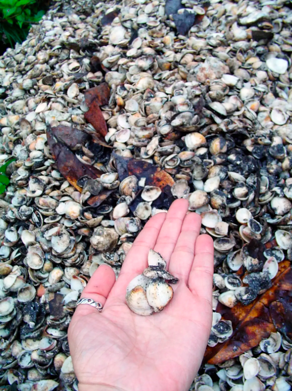
Long before the Indigenous peoples encountered by European colonizers at the time of Brazil’s discovery, this region was home to some of the continent’s earliest inhabitants. These were nomadic communities that lived in this territory thousands of years ago. Their way of life is known today through sambaquis—mounds of shells, refuse, and even human remains left in these ancient deposits, which can reach up to twenty meters in height. Among the most commonly found materials are food remains, especially shells of mollusks and gastropods (abundant along the coast), as well as remnants of hearths, structures, and burials. Sambaquis marked stopping points for these nomadic peoples and reached large dimensions due to the continuous use of the same areas by successive occupations of often distinct cultures. These layers allow us to analyze different moments in the timeline of these ancestors. Beyond the coast, similar archaeological sites can also be found in the Vale do Ribeira Sector, associated with the region’s rivers.
São Francisco do Sul is considered the third oldest city in Brazil and the oldest in Santa Catarina. Although there are no official records, it is estimated that in 1504 a French expedition landed on the shores of Babitonga Bay, which at the time was inhabited by the Carijó people, Indigenous to the region. Only in 1641 was the settlement of Nossa Senhora das Graças do Rio São Francisco officially founded. Shortly thereafter, Portuguese colonization took hold from 1658 onward, with the arrival of settlers from São Paulo and Portugal. In 1660, São Francisco was elevated to the status of a town (vila).
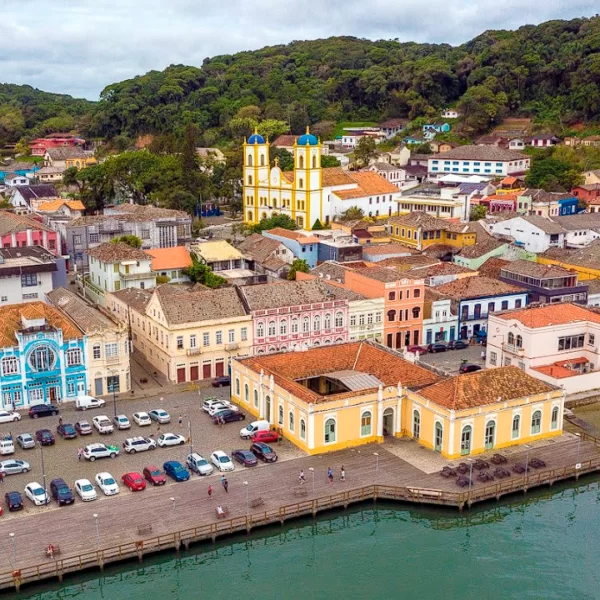
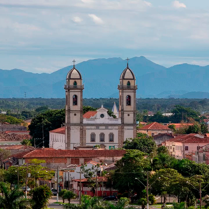
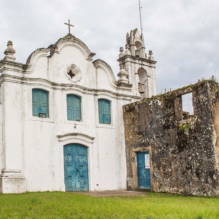
Paranaguá is a port city of great historical significance. It is the first urban settlement in the state of Paraná, with occupation of the region beginning around 1550 on Cotinga Island, alongside the start of gold exploration in Brazil. Later, trade developed between the ports of Paranaguá, Rio de Janeiro, and Santos. Due to its strategic position and the wealth—especially gold—found in the surrounding areas, the region became the focus of disputes between the Spanish and the Portuguese. The creation of the district of Paranaguá dates back to 1647, and about a decade later the urban center began to take shape around what is now the Main Church (Igreja Matriz).
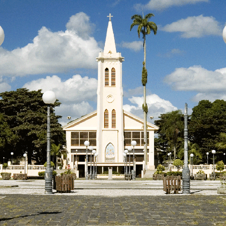
Antonina is strategically located at the inner end of Paranaguá Bay, at the foothills of the Serra do Mar. Its privileged position made it one of the first areas in Brazil to be explored by the Portuguese Crown. Historical records of its earliest settlers—mostly gold prospectors—date back to 1648. The region’s rivers served as routes connecting the coast to the plateau, allowing the transport of mining products. The city was founded in 1714, the year in which the Main Church was built in honor of Our Lady of Pilar. As the population grew, driven by gold mining and the port used for the landing and trade of goods, Antonina was elevated to the status of a town (vila) in 1797, with its early development strongly fueled by gold exploitation.
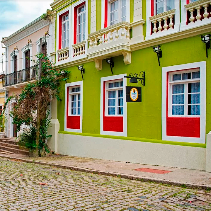
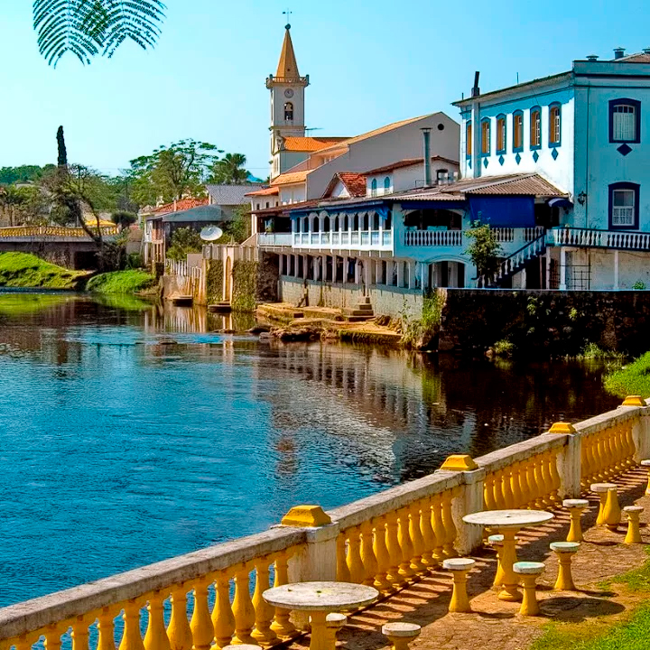
Today, Morretes is renowned for its restaurants and well-preserved historic townhouses; however, until the 16th century it was the land of the Carijó Indigenous people. As in other settlements in the region, the discovery of gold from 1646 onward was the main driver of European occupation, especially by miners from São Paulo. The settlement of Morretes was officially founded in 1721, and its name refers to the many hills of the Serra do Mar that can be seen from the area. Built along the banks of the Nhundiaquara River—which still captivates visitors and enhances the city’s historic center—the town experienced significant growth from this period on, with its commercial sector becoming a mandatory reference point for travelers moving up the mountains and along the river.
Guaraqueçaba was one of the first places reached by the Portuguese during colonization, around 1545. It was here that the history of Paraná began. Although time has passed, the town still preserves many of its original characteristics, including historic houses, a central square facing the bay, and caiçara culture, which can be experienced through traditional boats and Fandango dance gatherings. In Tupi-Guarani, Guaraqueçaba means “the place where guarás”—a bird species abundant in the region—“build their nests.”
The first time Portuguese settlers docked in this region was as early as 1502, during an expedition recorded at the Museum of Discoveries in Lisbon, which identifies the Cananéia region as the second stop made by the Portuguese in Brazil, shortly after the discovery of Porto Seguro in 1500. In order to better protect its territories, the Portuguese Crown founded Cananéia in 1531, considered the first city in Brazil. At that time, some Europeans from the earliest expeditions were already living among the Carijó Indigenous people native to the region. The municipality is located in an area of great tension between Portugal and Spain, as it lay along the imaginary line of the Treaty of Tordesillas, which divided the world between the two empires. As a result, its history is filled with legends of pirates, buried treasures, and battles—stories that continue to animate local conversations to this day.
The name Iguape originates from the Tupi language and means “river inlet.” The city was the stage for several historical events. Even before the settlement was founded in 1532, Spanish troops were already present in the region and had gained the support of the Carijó Indigenous people who lived there. When Portuguese forces attempted to reclaim their lands, they were ambushed in the mangroves of Mar Pequeno in what became known as the “Entrincheiramento de Iguape.” The counterattack that followed became known as the “War of Iguape,” during which, a few years later, forces composed of Spaniards and Portuguese exiles attacked and destroyed the village of São Vicente, located in what is now the city of Santos. After these events, the Spaniards moved toward the Río de la Plata, and the Iguape region remained under Portuguese control, although without direct obedience to the Crown.
With its mild climate and postcard-worthy beaches, the municipality enchants visitors with its exuberant natural beauty. Considered one of the cradles of Brazilian colonial history, Itanhaém stands out not only for its strategic location but also for its rich historical context. The city is home to a wide range of archaeological sites that reveal human presence from ancient sambaquis to more recent hunter-gatherer and agricultural groups. Itanhaém offers ideal conditions for water and aerial sports, thanks to its constant sea breezes and winds. The city is also recognized for its clean air, rich biodiversity, and rivers that provide calm and pleasant navigation. In terms of intangible heritage, Itanhaém preserves unique traditions such as the Festa do Divino—one of the oldest in Brazil—and the Reisado, which, in a distinctive local expression, celebrates not three kings but three queens. For all these reasons, Itanhaém is truly a treasure: a harmonious blend of natural beauty, culture, history, and tradition—a charming place, perfect both to visit and to live.
Text by Fátima Cristina Pires.